
xTexas Trail Sections
The trail is divided into seven sections, each offering distinct experiences—and distinct challenges. Because conditions can change and portions of the route are remote, travelers must take full responsibility for researching each section, reviewing maps, and preparing for the realities of the terrain. This page provides an overview to help you plan wisely and travel responsibly.
NOTE: The route through the Hill Country has just been updated to include Bandera on the route!
Section 1 - (Toledo to Richards/Eastern Terminus) - The Piney Way
Section 2 - (Richards to Lockhart) - The Bluebonnet Belt
Section 3 - (Lockhart to Bandera) - The Hill Country Climb
Section 4 - (Bandera to Sanderson) - The Devil’s Gap
Section 5 - (Sanderson to Marfa) - The High Desert Horizon
Section 6 - (Marfa to Dell City) -The Big Peaks Pass
Section 7 - (Dell City to El Paso/Western Terminus) -The Sun City Stretch
xTexas Trail Route by Section
Section 1 — Toledo, TX → Richards, TX
190 miles
This section winds through dense East Texas forests, agricultural roads, and small communities. Expect regular resupply opportunities every 20-30 miles and the most consistent access to lodging and accommodations on the entire route. Surfaces are a mix of pavement (88%) and gravel (12%).
Section 2 — Richards, TX → Lockhart, TX
171 miles
Entering the Blackland Prairie, this segment features rolling terrain, quiet farm-to-market roads, and dependable resupply every 20-30 miles. Lockhart serves as a major waypoint with full services before entering the Hill Country.
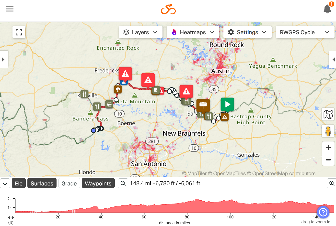
Surfaces are paved (97%) and gravel (3%).
Section 3 — Lockhart, TX → Bandera, TX
148 miles
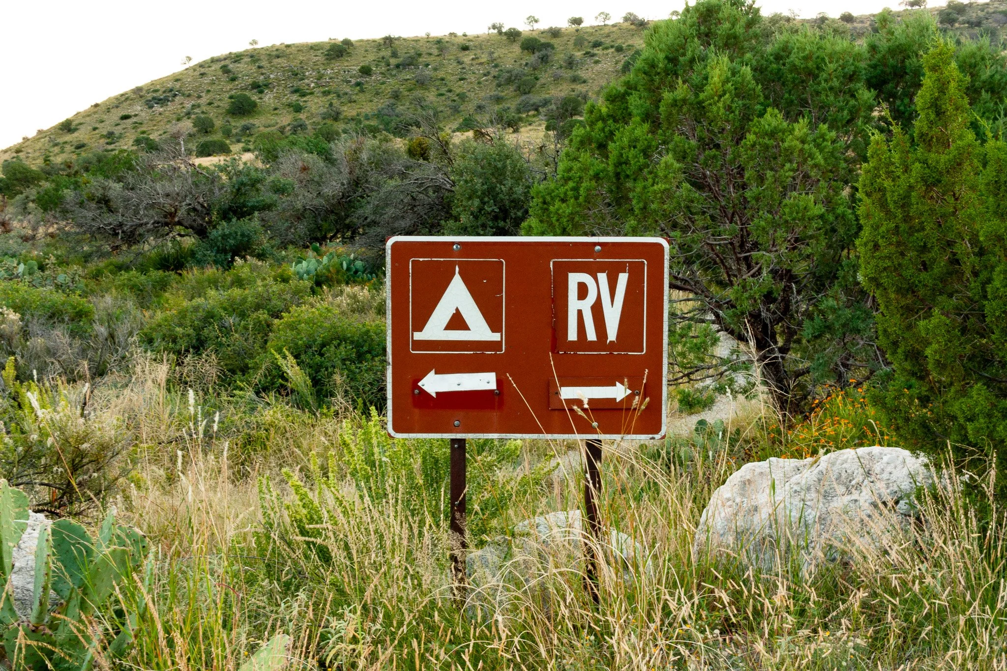
This section brings you into the Texas Hill Country—limestone ridges, scenic ranch land, and historic Hill Country towns. Surfaces include pavement, urban trails through San Marcos, and gravel. Terminating at the Cowboy Capital of the World Bandera.
Section 4 — Bandera, TX → Sanderson, TX
338.8 miles
This is the second-most rugged and remote section of the entire xTexas Trail. Rocksprings, TX is the last fully reliable resupply point before the route becomes dramatically more remote. That being said, Rocksprings is a very small town. Make sure that you are going to arrive in town when gas stations and the grocery store are open.
Once past Rocksprings, users will encounter:
100+ mile stretches with no water
Long segments of exposed roadway
Minimal to no shade
Extremely limited cell service
High heat and wind exposure
Long distances between communities
Vehicle support is highly recommended for all users traveling between Rocksprings and Sanderson.
Road surfaces include pavement and gravel.

Section 5 — Sanderson, TX → Marfa, TX
272 miles
This section goes through Big Bend National Park and Big Bend Ranch State Park.
Big Bend National Park
Currently, the route stays on paved roads due to Old Ore Road being closed after flooding in 2025.
River Road is OPEN.
If you plan to camp in Big Bend National Park, you must reserve sites ahead of time. Front country campgrounds are very busy in the late-fall, winter, and early-spring.
There are many backcountry sites along the gravel roads. If you plan to backcountry camp, you must obtain a permit at the Panther Junction visitor center.
Visitor Centers:
Panther Junction VC OPEN Daily 8:30 am to 5:00 pm
Chisos Basin VC OPEN Daily 8:30 am to 4:00 pm, closed for lunch
Persimmon Gap VC OPEN Daily 10:00 am to 4:00 pm, closed for lunch
Rio Grande Village VC OPEN Daily 9:00 am to 4:30 pm, closed for lunch
Castolon VC OPEN Friday, Saturday, and Sunday, 10:00 am to 4:00 pm, closed for lunch
“While some sections of the roads are smooth and easily traveled, many other sections which traverse bedrock and washes are extremely rough.” -Road Guide to Backcountry Roads of Big Bend National Park
River Road
This is a primitive 52-mile stretch of gravel that parallels the Rio Grande. That being said, most of the road is a considerable distance from the river.
See what the park has to say about River Road HERE.
READ Water Quality Along the Rio Grande.
Traveling east to west, there is river access at 13.9 at the end of the side road, Solis road. It is a 1.4 mile trek (one way) to the river bank.
Traveling east to west, there is river access at mile 23.2. Travellers should be prepared to travel an additional 6 miles (one way) to the river bank down Talley road.
Cell phone service is extremely limited within the parks.
Water sources in Big Bend National Park - See what the park has to say HERE.
Big Bend Ranch State Park
Closures:
Trail and camping access in the interior and Sauceda will be closed on the dates below.
Fort Leaton and Barton Warnock Visitor Center will remain open, as will river camping and certain trails along the corridor.
Please call Fort Leaton (432) 229-3613 or Barton Warnock Visitor Center (432) 242-3327 for clarification on closures if needed.
5 p.m. Nov. 16 to 2 p.m. Nov. 20: Mule Deer (youth)
5 p.m. Nov. 30 to 2 p.m. Dec. 4: Mule Deer
5 p.m. Jan. 4 to 2 p.m. Jan. 8, 2026: Quail
5 p.m. March 31 to 8 a.m. April 9, 2026: Survey
Section 6 - Marfa, TX to Dell City, TX
223 miles
This portion of the route traverses the Chihuahuan Desert, passes by the Davis Mountains, through the yucca fields of no man’s land, around the Guadalupe Mountains, and turns north towards the TX/NM border.
The section is 78% paved and 22% gravel.
It is extremely remote. There are many cattle guards making this section impassable for horses.
Section 7 - Dell City, TX to El Paso, TX (Western Terminus)
123 miles
The final section crosses about 100 miles of southern New Mexico, then comes back down to the magical and mystical Hueco Tanks State Park, before an arduous pass over the Franklin Mountains, spitting trail users out at the Texas–New Mexico state line.
NOTE: There is no backcountry camping permitted in Franklin Mountains State Park.
The section is paved (59%) and unpaved (41%).
The final stretch of the route requires true grit as you climb up over the Franklin Mountains and descend (or hike a bike) through a scree field into El Paso.