
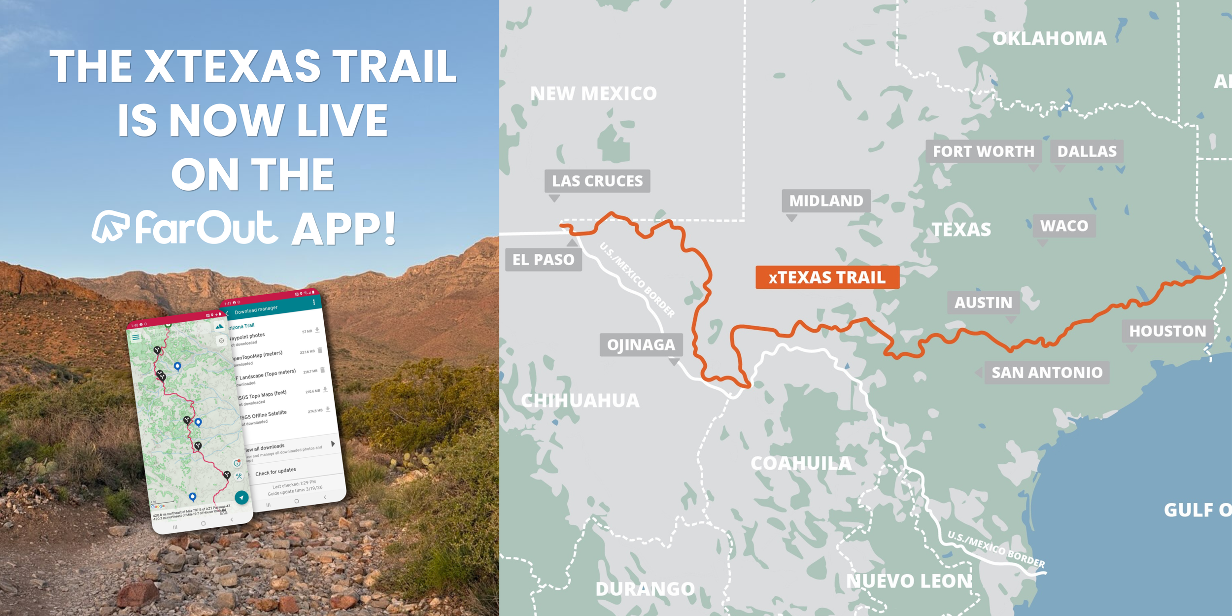
xTexas Trail Maps
The xTexas Trail is a long-distance, multi-use route crossing the state of Texas from east to west. The current version of the route uses existing public corridors—roadsides, shoulders, gravel farm roads, and 4x4 park roads—and represents the second draft of a long-term vision for a dedicated legacy trail.
The route is publicly available on Ride with GPS, and FarOut.
Please note: The xTexas Trail is NOT signed or marked on the ground at this time.
Travelers must navigate using GPS, downloaded offline maps, and personal route planning.
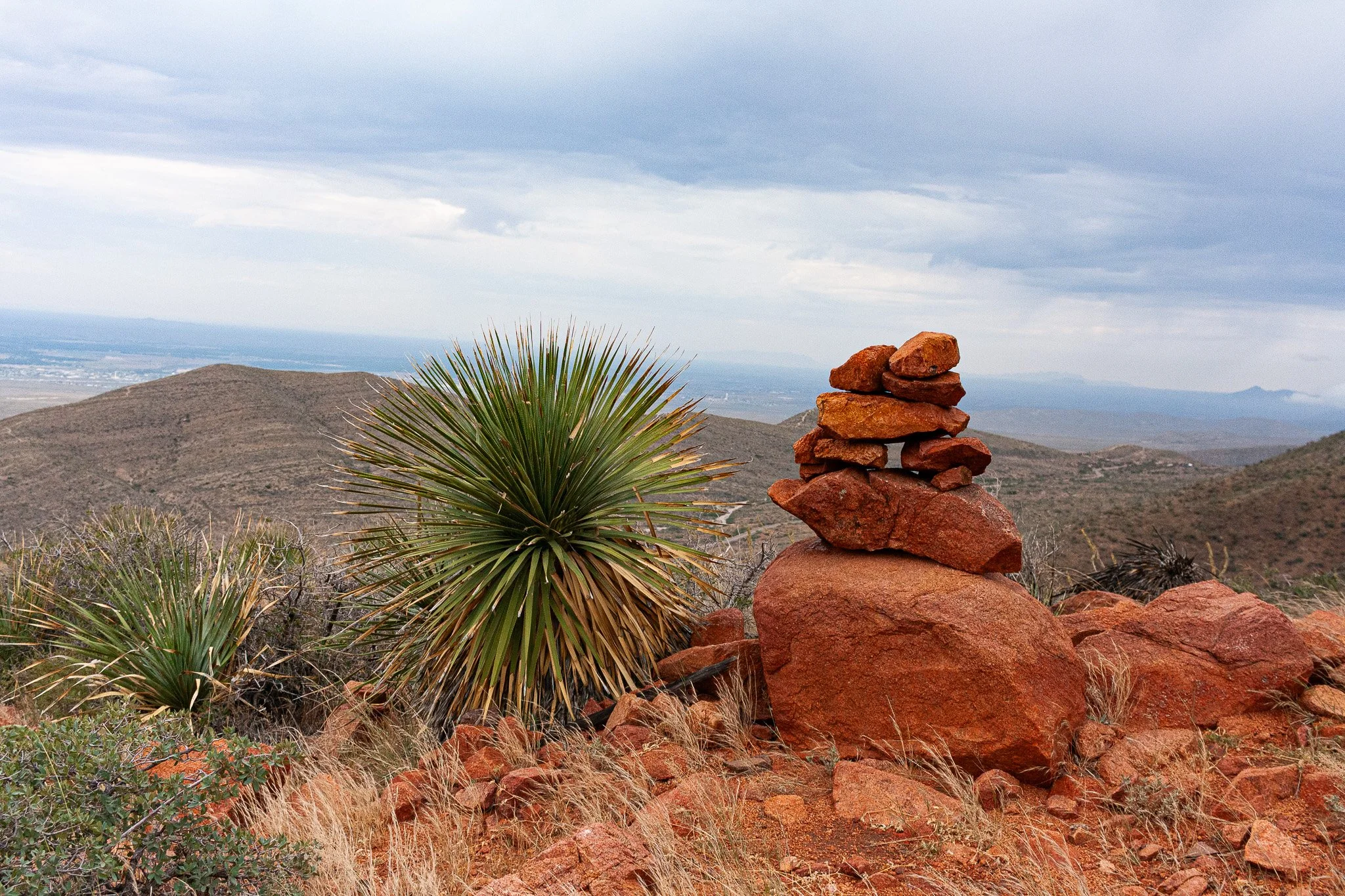
NOTE: The best times of year to traverse the xTexas Trail are late fall, winter, and early spring. For more detailed information about each section of the trail and what to expect, visit our xTexas Trail Sections webpage.
Who this Version of the xTexas Trail is For
This route is truly intended for everyone — cyclists, hikers, and equestrians. However, because the early-draft version relies heavily on roads and road shoulders, it is currently most user-friendly for cyclists.
We expect this to shift dramatically as new off-road corridors, easements, and trail infrastructure come online.
Your financial support makes a big impact!
Your donations fuel everything from operational support to help us grow sustainably; GIS mapping with hiker; cyclist, and horse-specific details; designing and piloting innovative water stops and rest facilities; permit and easement acquisition across Texas; volunteer coordination and training for hundreds of individuals who are eager to help; community events that bring together riders, hikers, and supporters; and operational support to help us grow sustainably.
Cycling the xTexas Trail
Because most of the present-day route follows public roads, cyclists will find this draft the most navigable. However, that does not mean it is an easy "bike tour."
While much of the route east of Rocksprings is paved or low-complexity gravel, the last ~500 miles are extremely adventurous. Cyclists should be prepared for:
80–100+ mile days (during the final ~650 miles) due to long gaps in refuel points
Limited to no cell service
Heavy exposure with scarce shade
Technical 4x4 roads
Some single-track sections
Long, remote stretches where self-sufficiency is essential
This is an advanced bikepacking route, especially in the western half of the state.
Hiking the xTexas Trail
Hikers may absolutely walk the route. To set expectations accurately:
~70% of the current draft is roadside walking
Shoulder width and road conditions vary widely
Exposure increases significantly west of Rocksprings
Long distances exist between water sources and refuel points
To help plan for terrain, hikers can view paved vs. unpaved sections directly in the Ride With GPS map.
This will become a more hiker-friendly trail as easements, off-road alternatives, and shelter infrastructure are built out in future phases.
Riding the xTexas Trail on Horseback
At this time, we do NOT recommend attempting the full trail on horseback.
Pavement, cattle guards, bridges, blind turns, highway speeds, and lack of water make several segments challenging or unsafe for equestrians.
The xTexas Trail Association is currently developing horse-healthy sections in partnership with landowners and anticipates expanding equestrian access as new multi-use corridors come online.
Water, Shelter, & Resupply on the xTexas Trail
Water availability decreases dramatically as the route moves west.
Critical Note
After Rocksprings, water and shelter are extremely rare. Some sections contain 100+ miles between refuel points—often with no shade, no cell service, and no reliable natural water sources.
Because most of these western stretches are roadside:
Water caching is not recommended. Caches are unlikely to remain secure or concealed.
Vehicle support is currently the safest option.
Exposure to heat, sun, and wind can be extreme.
The xTexas Trail Association is actively fundraising to build a network of water and shelter stations across Texas, which will dramatically improve the safety and accessibility of this route for all users. This is a years-long endeavor, but as new water sources and shelter stations become available, they will be added to the navigation files.